UBC researchers have unearthed new insights into the role that trapped liquids play along a portion of a major fault line off British Columbia's coast, including the possibility that water escaping from pores in the ocean crust deep beneath Vancouver Island might be the cause of regular tremors.
The Cascadia megathrust fault—the boundary between two of the Earth's tectonic plates—runs along the length of North America's western coast from northern Vancouver Island to northern California. The so-called subduction zone—where one tectonic plate slides under another—is the site of massive but infrequent earthquakes.
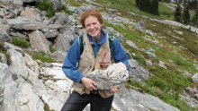
In the case of Cascadia, it is also the site of surprisingly regular 'slips' and small tremors, roughly every 14 months. "We know that the area where the two plates meet is sealed, and that free water from dehydrating minerals—under tremendous pressure—is trapped in pores within the crust of the descending plate," says lead author Pascal Audet with UBC's Department of Earth and Ocean Sciences.
"These findings suggest that there is also a deeper portion of the fault area that is more permeable—pressure builds and water escapes periodically, causing fractures along the plate interface, which may explain the characteristic regular slippage and tremors."
The findings were published in this week's issue of Nature by Audet (now a Miller Research Fellow at the University of California Berkeley) and fellow UBC EOS researchers Michael Bostock, Nikolas Christensen and Simon Peacock.
While the study is a first detailed glimpse at the geological mechanics beneath island, expanding the seismographic sensor system used to monitor the area, either by placing more sensors on the Island or expanding the sensor array into the waters west of Vancouver Island, would give researchers a clearer picture.
"Deploying offshore seismometers would give us a more complete picture," notes Peacock. "It would be particularly valuable to determine whether the fault properties change over time as we progress through the earthquake cycle, and where the changes are most significant along the fault."
One of the world's largest earthquakes occurred along the Cascadia megathrust in 1700 when it ruptured along a 1,000 kilometre stretch from Vancouver Island to northern California. While this type of offshore earth quakes can be massive, they only occur every 600 years and aren't necessarily the greatest earthquake hazard faced by the west coast. Smaller inland quakes can pose greater risks because of their proximity to urban areas.
"While scientists are still a long way away from being able to predict earthquakes, this study brings us one step closer towards understanding the physical state of the megathrust fault and the earthquake cycle as a whole," says Audet.
Read about other news...
-
Will B.C. get a charge from lithium?
November 12, 2025
How the discovery of the first major lithium-bearing pegmatite in B.C.—and the geochemistry behind it—could help make Canada more self-sufficient in critica read more
-

New CRCs include focus on software, AI-driven health research
October 22, 2025
New CRCs focus on software security, electrocatalysts for carbon recycling, isotope geochemistry, quantum systems, and AI-driven cellular health studies. read more
-
New mega RNA virus may hold the key to mass oyster die-offs
August 5, 2025
Scientists have discovered a previously unknown virus in farmed Pacific oysters during a mass die-off in B.C., Canada. The discovery serves as a reminder that growers should exercise caution when moving young oysters internationally and domestically, to prevent potential spread of pathogens,… read more
Musqueam First Nation land acknowledegement
We honour xwməθkwəy̓ əm (Musqueam) on whose ancestral, unceded territory UBC Vancouver is situated. UBC Science is committed to building meaningful relationships with Indigenous peoples so we can advance Reconciliation and ensure traditional ways of knowing enrich our teaching and research.
Learn more: Musqueam First Nation
Faculty of Science
Office of the Dean, Earth Sciences Building2178–2207 Main Mall
Vancouver, BC Canada
V6T 1Z4